GeoCoordination Services
From the backstage, clicking on GeoCoordination Services displays the GeoCoordination Services dialog.
|
Search Area |
By default, the map displays the concept extent that has been defined when creating the file. This area can be edited. |
|
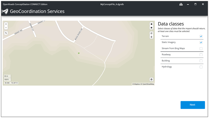
Data classes |
Select at least one class. The selection filters the results set to return from the server. |
|
Next |
When clicking on the Next button, a connection to the server is done and the search process is launched. |
Results

Note: The correlation between the resolution and the file size is not always constant. In some cases, you might observe a smaller size for high resolution data, while the medium or low resolution data displays a higher number for the file size.
Terrain file location - defines the location and the name of the terrain file (3sm) to be created. This file can be reused to create different alternatives by attaching it to other dgndb files. Refer to the Attach section for more details.
Size - refers to the number of bytes (storage space) required to save a file on disk.
Image Size - refers to the dimensions of an image, the image's height and width. An image's screen size refers to how large it appears on a computer display, usually measured in pixels.
Image Resolution - is a measurement of the output quality of an image. Another way to think of it is as the density of an image. Resolution is usually referred to in terms of pixels for screen display.
Refer to the following for additional information: